Friday, June 06, 2008

Here is the link to Lisa's excellent Brown Bag on the Soil Survey SSURGO Database!

Monday, June 02, 2008

Thursday, May 29, 2008

Jen's Watershed Brownbag

Here is the link to Jen's Brown Bag on Watershed Analysis in ArcHydro....

GPS Brown Bag by Becky Schalk and Mark Moore

Here is the link to Mark and Becky's Brown Bag presentation on GPS...

New Web Mapping Services from NYS DEC

New natural resource maps and other environmental information are part of a recent expansion of the New York State Department of Environmental Conservation's (DEC) website. The Mapping Gateway - http://www.dec.ny.gov/pubs/212.html - will provide DEC's partners and the public with a range of services that consolidate and enhance accessibility to DEC's extensive geographic information on a large variety of environmental topics.The Mapping Gateway combines existing web mapping applications and map collections with new offerings, including a full-featured, interactive data inventory with over 35 datasets and a new Map Viewer that can pull in web map services from other organizations. We're particularly excited about broadening access to our geographic data through the use of file formats compatible with virtual globe software including Google Earth.Please feel free to send me comments and suggestions, as the Mapping Gateway is an evolving public service. For more, see the recent press release at: http://www.dec.ny.gov/press/44059.html .

Regards - ChrisChristopher O'ConnorProgram ManagerDivision of Information Services, NYSDEC cxoconno@gw.dec.state.ny.us 518.402.9140

Wednesday, May 21, 2008

NYS GeoSpatial Summit 2008


Currently speaking is Vincent Virga, the author of Civilizations


Amazon link here: http://www.amazon.com/Cartographia-Mapping-Civilizations-Vincent-Virga/dp/0316997668

I'll bring back a copy for everyone.... Jack Dangermond is next!


Friday, May 16, 2008

OGS WMS Mapping Layers

Following up on the last post about the NYS Orthoimagery WMS Mapping layer, there are more and more layers available.

See this site: http://www.skylab-mobilesystems.com/en/wms_serverlist.html

If you see a WMS layer of interest, Right-click the name in Internet Explorer and choose "Copy Shortcut". Then go into ArcCatalog and create a new WMS Mapping Service. (See instructions previous post). Enter the URL of the WMS you want in the dialog box, and add your service!

New York State WMS Orthoimagery Service

New York State has made available all of it's Orthoimagery via a "WMS Layer" (Web Mapping Service). This should prevent everyone from having to download NYS Orthos for each project. It's slow, but not terrible.


Open ArcCatalog, and "GIS Servers". Double click "Add WMS Server"


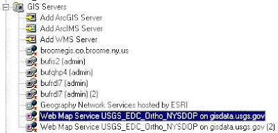
Enter this URL: (you DO need the question mark at the end)
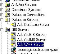

http://gisdata.usgs.gov/wmsconnector/com.esri.wms.Esrimap/USGS_EDC_Ortho_NYSDOP?


This will add a new web service for the Orthos. When you go into ArcMap, and click "Add Data", you will browse a list of images from different ortho programs (i.e. "WNY Color 2005" vs. ENY Color 2004"). You will need to know the section of the state you are looking for, as well as the year and image type (b&w / infrared / color)

Information on the photos collected each year can be found here:
http://www.nysgis.state.ny.us/gateway/orthoprogram/index.cfm

More information about the state WMS program can be found on this page
http://www.nysgis.state.ny.us/gateway/mg/webserv/ins_arc.html

It's not up and running 100% of the time, but seems pretty reliable.

Cache Error When Using Snapping on 9.2 Measure Tool


A few folks mentioned this one (Jen, Mike G)..... In 9.2 we can now snap to features when using the Measure Tool (this feature was a long time coming!) However, you can sometimes get the error message when snapping on a measure.
This is because, when snapping on a measure is enabled, ArcMap builds an internal cache of "snap points" (Vertices, etc.) If there are too many of these on the screen, the program can raise this error.
Unfortunately the only solution seems to be to zoom in closer, to reduce the number of snap points, and try again. I checked Advanced ArcMap settings, and the forums and did not come up with much else of a solution
Forum reference:

Thursday, May 15, 2008

Weird ArcGIS Startup Error At Fort Hood

Last week Mike reported a strange error at Fort Hood... Many ArcMap desktops started failing simultaneously. Upon startup, the computer wanted to continue with an ArcGIS installation, asking for the disk to continue installation.

Mike G, after some sleuthing determined that some Office files were missing on these machines - we are not sure why.

These files are located in
C:\Program Files\Common Files\Microsoft Shared\Office10\
Mso7ftp.exe
Mso7ftpa.exe
Mso7ftps.exe
Mso.dll
Riched20.
dll


When the files were replaced, the software once again worked fine.... (Thanks Mike!)

Thursday, August 10, 2006

Geodatabases in 9.2

Update: NO more spatial domains having to be set beforeheand. With new high precision storage, that won't be necessrary.

Geodatabases now will also suport vertical references.

Spatial grids for quicker drawing are now automatically recalculated.

ECW images are supported.

RASTER ATTRIBUTE TABLES! (It's about time, 15 years later). Add attribute tables to GRID, SDE Rasters, TIFF, etc.)

"Image Pansharpening" is possible and orthorectification on the fly. (Lisa?)

Editing of versioned or non verisoned SDE data now possible.

Insert shapes DIRECTLY into SQL SERVER using SQL commands, instead of having to go trhough ArcMap, etc.

ARCHIVE on geodatabases to quickly view how FC's looked at a specific point in time.

Disconnected editing has more options